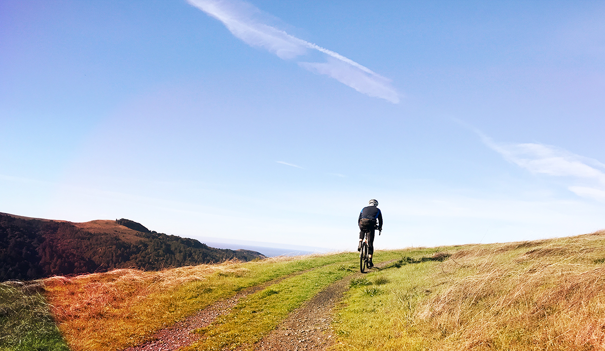
Fort Seward Rd.’s uninterrupted steepness was punishing on our loaded touring bikes. But I had promised Eric and Sergio a stop for lunch at some point on the climb so as we emerged from the forest to a sweeping view back down to the Eel River’s North Fork there was no doubt this would be the spot. Little did we know that the emotional high of our gourmet backcountry lunch with an epic view would be followed by the emotional lows of a major mechanical problem and unrelenting cold rain. The rhythm of ups and downs, whether climbs and descents or elation and gloom, would come to define the Hidden Eel Lost Coast route.
All bike tours have rhythms. From the tapping out of pedal strokes to the routines of waking to the sun and filtering water. But the rhythms of the Hidden Eel Lost Coast route were unexpected.
Actually, the steady rain greeting us on our first morning was entirely expected. So too were the carless gravel roads taking us up and down repeatedly to our crossing of the Middle Fork Eel River. Also expected was the break in the rain midday as we stopped for lunch in Covelo. After warm tamales from the IGA, spirits were high as we headed out of town. But the lows would soon follow as scattered rains returned, the climbs seemed to get longer and steeper, and we were miles from our intended destination.
By the time we finally made the ridge along Zenia Lake Mountain Rd. it was clear that we’d end the day by finding a camp spot along the ridge rather than dropping down with the cold air into the valley below. Following a spectacular sunset and good night sleep, the next morning had us rolling further along the ridge to the Kettenpom store. A local warned of an imminent storm and recommended a re-route. Eyeing our bikes, he suggested a paved climb instead of our planned dirt ascent of Fort Seward Rd.
After a descent that seemed like it would never end, we decided to stick to our route and dropped even further before crossing and paralleling Dobbyns Creek into Fort Seward. Still no rain. What luck! We commenced the climb, hit our lunch spot, then packed up to carry on.
By now we should have been prepared for the ups and downs. But then Eric discovered a pair of decimated brake pads and a destroyed retainer clip. Down. Wait, it seemed like the spare I was carrying would fit in Eric’s calipers! Up. Nope. Eric would have to finish the climb and make a big wet and muddy descent on nothing but a rear brake. Down.
I always prepare bailout options for a tour. You never know when you might need to get to civilization. Our Plan B was to temporarily leave the route by dropping down to Avenue of the Giants and finding a place to get out of the rain while we came up with a way to get back to Plan A. We knew there would be no bike shops. But Eric was convinced with some time and a file he could MacGyver my spare pads to fit into his calipers.
So we stood under the awning of Redwoods Market & Deli in Myers Flat, eating warm chicken parmesan sandwiches and dreading heading back out into the rain. We knew we could get back on route in eight miles and that there would be a campground in Humboldt Redwoods State Park five miles further along Mattole Rd. Sergio seemed ready to go for it. But there would still be uncertainty as to whether Eric could MacGyver the spare pads so he’d have a front brake the following day which would take us down the Lost Coast and into the rugged dirt trails of the King Range National Conservation Area.
I proposed seeing if we could find a motel for the night rather than try to set up a camp in the rain with no chance of anything drying out by the morning. A consensus formed and we went into action to see what we could find. Up. But the only motel in town seemed to be closed for the season. Down. Then Eric spotted a sign–“Giant Redwoods RV Resort. Cabins. Free WiFi. Open Year Round–”we soft pedaled the quarter mile down the road where the sign pointed to see if they had a cabin available. Yes! Definitely up. Also up? A laundry room where we could dry out our wet gear.
Sergio got to work on the laundry while Eric started grinding away on the spare pads. In shorter order we had dry gear and an operable front brake for Eric’s bike. We spread our sleeping bags out on the cabins’ beds, fired up our camp stoves on the front porch, and went to sleep warm, dry, and with full bellies.
We laughed at the gentle drizzle the next morning. It was nothing compared to what we’d ridden through the day before. Plus we were flying along on the smooth pavement of the Avenue of the Giants while soaking in the energy of the graceful giants among us. Back on route we absorbed even more beauty along Mattole Rd. before the big climb up the other side of which would drop us into the town of Honeydew.
By the time we arrived at the Honeydew Country Store it was time for lunch and the sun was peeking through some big white clouds. By midday it seemed like nothing but ups. We should have known the next down was around the corner. Only it was actually an up, in the form of another grueling climb, that we faced after leaving Honeydew. The down came in the form of a downpour that accompanied us for the rest of the climb and ride along the ridge.
If there are ups and downs on every tour, there are obviously also low and high points. But never knowing what lies ahead, any particular ‘down’ may or may not be the absolute low point. Despite this, on that climb of Wilder Ridge Rd. each of us hit what we hoped must surely be the low point. For me it was the moment when the rain stopped sheeting off my back and instead found a path down my back and into my pants. “At least my feet are still dry,” I told myself as I checked that my booties were still tight around my lower leg.
Riding in wet conditions is bearable, especially when the temps are significantly above freezing, as long as there is a possibility of getting dry and warm in the foreseeable future. We all had dry gear safely stowed in our panniers and seatpacks. But the last thing you want to do is put your only remaining dry gear on when the end of rain is uncertain. So we pedaled through the low, soaked nearly everywhere, keeping the dry gear in reserve.
By the time we turned onto Kings Peak Rd. for the 1,000’ descent into the King Range National Conservation Area, the rain had stopped. Before long we’d begin to dry out if not for the water dripping from the trees and the frequent creek crossings. We should have made good time now that the rain had stopped, but we couldn’t resist stopping frequently to gaze at the lush forest, swollen creeks and cascading waterfalls. Once again on this tour, a major down was followed by a big up.
But we had a big decision ahead of us. Kings Peak Rd. had become increasingly sloppy as we approached the junction with Shelter Cove Rd. And we knew that Usal Rd., on our intended route, would likely be magnitudes worse. In some ways the decision was already made. We had agreed that if we made the junction by 2:30 we would make a decision as to whether to attempt Usal Rd. But it was already 4:30 when we hit the junction so the only decision was whether to descend off route 1.5 miles and 800’ to resupply at the Shelter Cove Store. Wiped out from two big climbs and a saw tooth elevation profile through the King Range, a consensus emerged to skip the resupply. We would descend Shelter Cove Rd. heading east and look for a place to camp.
It may not always work this way, but there often seems to be a karmic balance sheet on a tour. Enduring through challenges promises some sort of reward. We have to think this way, or there would be no compelling reason to push through the low points.
And as it turned out, karma worked in our favor on our final day as we encountered mostly dry roads and climbs that never seemed too taxing. After a lunch stop at The Peg House in Leggett, we were pushed along the final miles not only by tailwinds but also the mild euphoria and gratitude of having completed a challenging tour.
For details on the route go to the Hidden Eel Lost Coast Tour page. For insider tips on breaking up the days, camping and other lodging options, alt routes where dirt roads may be impassable in wet months, water during dry summer months, resupply options, bailout routes, and more, contact us by email.