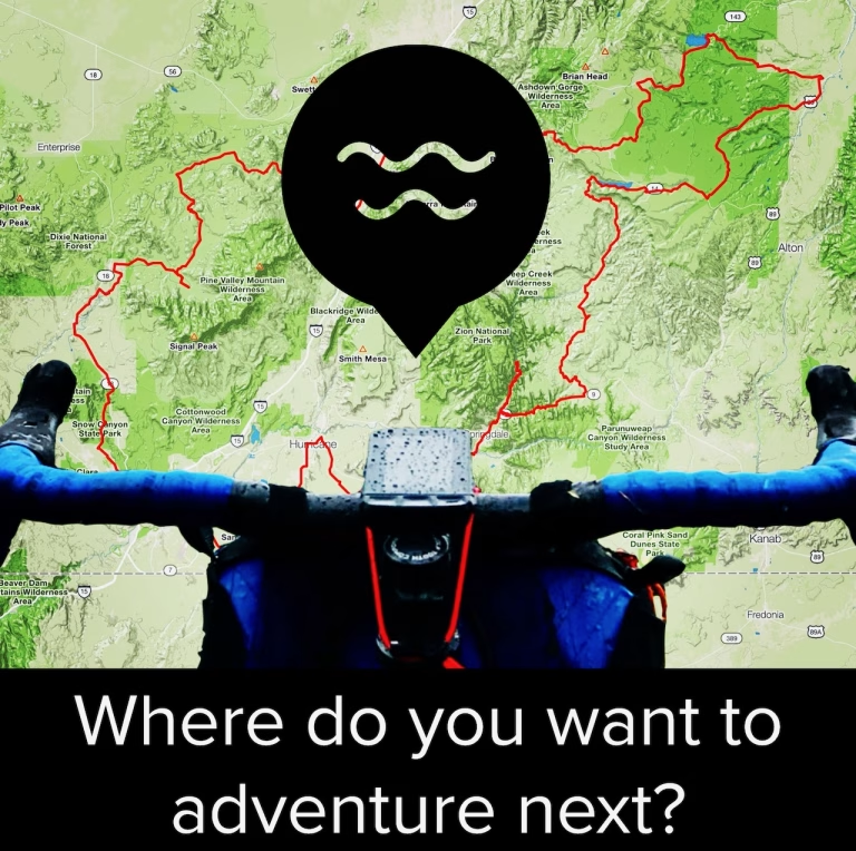
Have you ever navigated a route you found on Strava or Ride with GPS only to discover a locked gate, unrideable single track, or another unpleasant surprise that ruined your ride?
Creating your own adventure cycling routes can spare you from this frustration. That’s where Adventure Cycling Tips #4 and 5 come in.
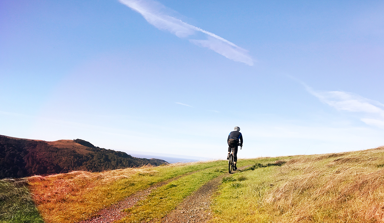
To “wander far and wise” is to explore new and unfamiliar places while minimizing the likelihood of getting lost
Wander Far and Wise
Part of what I seek in adventure is a sense of getting lost without actually getting lost. That’s why Comova’s tagline “wander far and wise” is so fitting.
To “wander far and wise” is to explore new and unfamiliar places, but with a route and a plan that can help minimize the likelihood of getting lost, getting hurt, or getting stuck. So, how do you find, research and create routes that lead to adventure and not misadventure?
This used to require having multiple browser tabs open to access different websites and platforms, and using Google Streetview and Google Earth (or satellite view) to try to get as accurate an idea as possible of what the route actually looks like on the ground.
All of this can now be done within Ride with GPS (RWGPS). Sure, Strava, Komoot, and other services offer similar functionality, but RWGPS is the only one that is, at its core, a route-building platform. Rather than put resources into building a social media service, RWGPS is first and foremost a platform for researching, designing and building routes.
So Tip #4 is to get yourself set up with a RWGPS account. It’ll need to be at the premium level for access to the most important route creation tools. But if you really want to become an expert route builder, it is totally worth it.
Before starting to build a route, get familiar with the tools by following these steps:
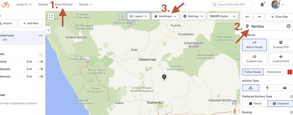
- Using a web browser, click the “route planner” link at the top of any RWGPS page
- In the “Enter a location” field, type in the name of a place you’d like to ride (e.g., Namibia).
- On the “Heatmaps” dropdown menu turn “Global Heatmaps” on (and tick the “All time” button
If there is no heatmap activity where the map shows a road, it usually means one of several things: the map is wrong or outdated and there is no road there, the road is private or otherwise illegal to ride on (e.g., an interstate highway in the U.S.), or extreme conditions have prevented other riders from attempting it.
Whichever is true, you probably don’t want to route yourself on that road unless you’re prepared for a higher level of uncertainty. Of course, everything you need is right inside RWGPS, including Google street and satellite view. Try these steps next:
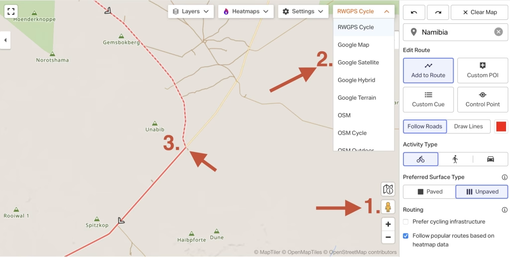
- Drag and drop the little yellow person onto the road you want to investigate. If the road is blue, your map will switch to street view. If not, it means Google hasn’t photographed it. That’s either because Google simply hasn’t been there yet (the likely situation for our test case in Namibia), or that the road is unpaved (Google trains its drivers to stay on paved roads).
- If there’s no street view available, use the dropdown map menu to switch to the Google satellite map. Now you can zoom down to get a pretty good sense of what the road looks like. Still not sure?
- Drop a start pin on your map and then start routing along the road in question. RWGPS denotes unpaved roads with a dashed line so where your line changes from a solid to dashed line, your route is going from paved to unpaved.
To truly understand the route you’re building requires an iterative process. For example, the algorithm RWGPS uses to identify road surface types is not always accurate. I have found false positives (a road is actually unpaved when indicated as paved) and false negatives (a road is actually paved when indicated as unpaved).
So I often circle back to step 2. above and use Google satellite maps, zoomed in as far as possible, to try to determine the surface of a road. Ever heard of forests? Yeah, this technique doesn’t work so well when there’s tree cover!
But you get the idea. Using a range of tools, all available within RWGPS, it is possible to compile a relatively comprehensive picture of what a route looks like and how challenging it may be.
If you’re new to route building, or have questions on how to become more proficient at using the powerful tools RWGPS offers, let’s get on Zoom or Google Meet so I can screen share and walk you through some of the nuances. I love doing this so much I’m offering this as a free service.
The “Let’s Talk” button below will take you to Calendly to schedule a meeting. Be sure to drop your question or some details about the route you’re interested in finding or building into the note when scheduling. That way I can be prepared for our meeting.
But wait! What about Adventure Cycling Tip #5?
Let’s say you’re not quite ready to research and build your own routes. Then you might like to know where you can go to find quality adventure routes that have been vetted by other riders.
You’re in luck. There are now multiple route libraries available at regional, state, and national levels (and even internationally), created by individuals and nonprofits eager to get more people out riding great routes.
Where can you find them? Comova’s Gravel Route Planning Guide
The guide includes a list of gravel and adventure route libraries to get you started. Plus more details on using RWGPS and other route building tools.
What’s even better is that many of these route libraries are stored in RWGPS. So if you find a route you like but you want to shorten it, or maybe you just want a different start point, just make a copy and then start editing it using your new route building skills.
There you have it: Adventure Cycling Tip #5 is to hit the button below and start exploring the route libraries listed on page 6.